
Prospects
Jacks Creek – Gold
- Historic drilling (1990-91) over 1.3km strike, with all drilling very shallow (15-24m, deepest 39m below surface). Highlights include:
- 7m @ 2.47g/t Au from 6m 7m @ 1.73g/t Au from 11m
- 7m @ 1.25g/t Au from 4m 7m @ 1.01g/t Au from 11m
- 6m @ 1.72g/t Au from 25m 5m @ 4.23g/t Au from 9m
- 5m @ 2.98g/t Au from 21m 4m @ 1.96g/t Au from 11m
- 3m @ 4.22g/t Au from 22m 2m @ 3.36g/t Au from 46m (EoH)
- Jacks Creek Extensions: Jacks Creek North & South stream sediment sampling has identified gold anomalies over a strike of 15km, with the southern area possibly having a better host rock as indicated by a magnetic anomaly which suggests mafic-ultramafic lithologies
- Note – Historic drilling based solely on Arsenic soil anomalies (no Au assays completed prior to drilling) – potential displacement from main gold mineralisation

Prospect Locations and known Gold, REE, Nickel, Cobalt and Tungsten mineralisation within EPM 26360. Rock Chips at Jacks Creek up to 10.95g/t Au.
Jacks Creek – Gold
-
Gold and multi-element soil sampling (5 traverses) was completed for first time at Jacks Creek by Sturt in October 2021. Very high-grade Au (+/- As and Sb) results up to 459ppb outlined. Open to north and south.
-
Main high-grade Au zone immediately east of regional N-S trending regional scale fault. Lower-grade Au zone (to 43ppb Au) west of fault also outlined.
-
Subsequent campaigns by Sturt in 2023-24 has taken the number of of infill and extensional soil traverses to 36 with Au results up to 534ppb
-
Detailed and reconnaissance soil programs (and rock chip) planned to extend zones and identify more anomalies along the full strike of Jacks Creek fault
-
Maiden RC and diamond core drilling campaigns planned

Jacks Creek (looking north). Note – easy track access to site, historic PVC collars. Also shown are historic dillhole collars (circa 1990-91) which will be rehabilitated after planned SEM RC/core drilling.
Jacks Creek – Gold
- Discovered by regional stream sediment sampling, with all subsequent drilling very shallow (~18m below surface).
- Lynch Mining completed, Arsenic (As) only, detailed soil sampling at Jacks Creek circa 1989-90
- Lynch Mining completed percussion drilling at Jacks Creek 1990-91 (over 1.3km strike), although all drilling very shallow (typically 15-24m) with drillhole JC034 the deepest 39m below surface – 2m @ 5.28g/t Au stopped in mineralisation
- Gold and multi-element soil sampling (16 traverses) completed by Sturt 2021-24 (first multi-element soil survey at Jacks Creek)
- Outlined an extensive very high-grade gold and srsenic anomaly (+/- Sb), which is clearly still open to north and south
- Sturt has completed 901 samples to date with gold to 534ppb (Arsenic to 1,042ppm)
- Stream sediment sampling followed by soil sampling are rapid cost-effective techniques to target gold mineralisation at Jacks Creek
- Multiple drill ready targets on the Au (and As) soil grid
- Gold and multi-element soil sampling required along full length of Jacks Creek fault (circa 15km strike) and infill sampling on current soil grid prior to drill testing

Rocky Dam (red) tenement, Central Jacks Creek Au soil anomalies (refer Legend) on Satellite image.


Rocky Dam (red) tenement, Full coverage of Jacks Creek As soil anomalies (refer Legend) on Satellite image.

Jacks Creek drillhole section, shows deepest ever drillhole JC034 which stopped in high-grade gold mineralisation

Jacks Creek, Jacks Creek North and Jacks Creek South Gold Soil Sampling Contours (dark blue Au +10ppb, light blue Au +20ppb, green Au +50ppb, yellow Au +100ppb, orange Au +150ppb and red Au +200ppb – maximum 534ppb Au)
Suprendre – Gold
- Discovered by regional stream sediment sampling, with all subsequent drilling very shallow (~24m below surface).
Suprendre Arsenic Soil Assays and Drilling Results
- Metana Minerals completed, Arsenic (As) only, detailed soil sampling at Suprendre in 1990-91 (1,144 samples)
- Arsenic being an excellent pathfinder element for gold mineralisation
- Outlined coherent and extensive high-grade Arsenic anomaly (open to north and south)
- Arsenic to 690ppm
- Only very shallow drilling completed at Suprendre (190-94) – good Au intercepts
- Multiple drill ready targets on the As soil grid
- Multiple drill ready targets on Qtz Vein (northeast of the As soil grid)
- Gold and multi-element soil sampling required on main Suprendre zone (north and south extensions), Qtz Vein area and other prospective fault zones
Metana Minerals completed SU series drillholes at Suprendre in 1990
- SU series drillholes (very shallow) – 18 holes for 450m (av. 25m), longest 35m, dip 55 degrees
- Selected significant drill results;
- 4m @ 1.26g/t Au from 18m 5m @ 0.97g/t Au from 10m
- 3m @ 1.22g/t Au from 16m 4m @ 0.47g/t Au from 2m
- 6m @ 0.54g/t Au from 5m
Dominion Mining completed SURB series drillholes at Suprendre in 1994
- SURB series drillholes (very shallow) – 40 holes for 1,078m (av. 27m), longest 33m, dip 60 degrees
- Majority of drillholes concentrated on outcropping Quartz Vein, northeast of Metana soil sampling grid
- Selected significant drill results;
- 18m @ 1.2g/t Au from surface (incl.10m @ 2.0g/t Au from 2m) – Qtz Vein
- 24m @ 0.8g/t Au from surface (incl. 4m @ 4.09g/t Au from 12m) – Qtz Vein
- 3m @ 0.9g/t Au from 9m – Qtz Vein
- 3m @ 0.5g/t Au from 12m – Qtz Vein
- 3m @ 2.39g/t Au from 3m

Rocky Dam (red) tenement, Suprendre As soil anomalies (refer Legend) on Satellite image. Metana Minerals SU drillholes (Red) and Dominion Mining SURB drillholes (Blue- principally Qtz Vein drilling) also shown. Kidston pumped hydro duplicated powerline (pink).

Wolfram Hill – Tungsten
- Wolfram mineralisation occurs in gently dipping quartz veins in hornfelsed altered mudstone. About 20t of handpicked concentrates were produced between 1937 – 1947. Rock chip assays W to 1.9%, high grade W in soils (2010).
- Never drill tested.
- Extensive rock and soil sampling planned.
Bitumen and Cobree/Cobree South – REEs, Co and Ni
- Bitumen and Cobree prospects have been sporadically sampled by previous explorers with assays of up to 0.5% Y2O3, 0.75% Ce2O3, 1.8% Co, 0.4% Ni and 0.5% Li2O have been returned.
- In 2018, 22 rock chip samples were collected by Sturt from Mn and Fe grits at Bitumen and Cobree which returned:
- Co to >1%, Li to 0.12%, Cu to 0.15%
- Ni to 0.43%, Ce to 3100ppm, Dy to 306ppm
- Er to 159.5ppm, Eu to 87.4ppm, Gd to 39.5ppm
- Ho to 62.1ppm, La to 244ppm, Lu to 219ppm
- Nd to 705ppm, Pr to 128.5ppm, Sm to 234ppm
- Tb to 52.2ppm, Tm to 23ppm, U to 18.8ppm
- Y to 1570ppm, Yb to 131.50ppm, Mo to 24ppm
- Sc to 68ppm
- Cobree South – rock chip sampling up to 5.2g/t Au with elevated Bi (up to 1,800ppm), Ag (to 100g/t) and Pb (to 400ppm).
- Extensive rock and soil sampling and mapping planned (potentially REE clay hosted mineratization).
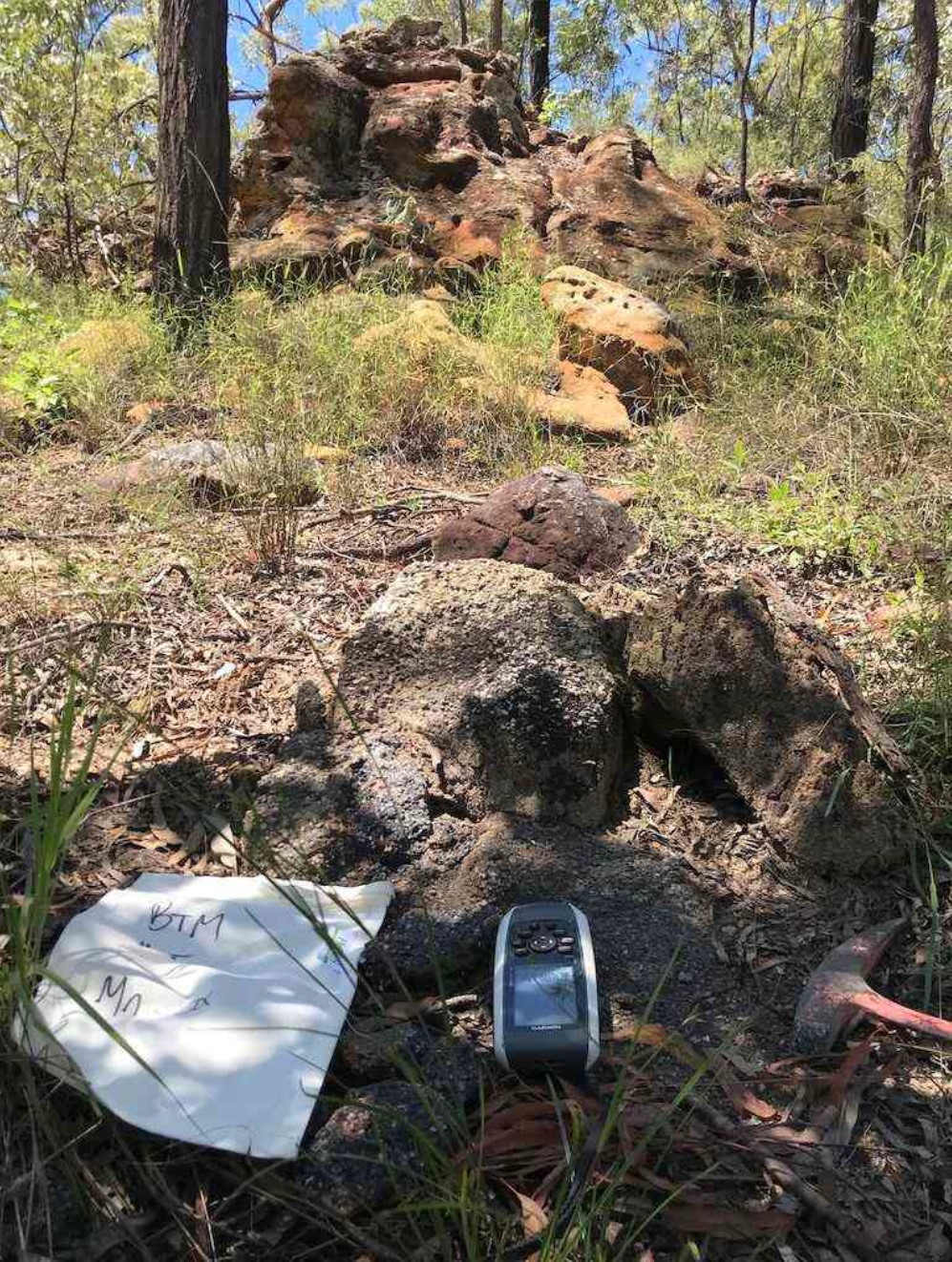
Bitumen REE, Co and Ni prospect. Manganese grit foreground and ferruginous grit background.